Saturday, 16 December, the weather outside wasn't frightful and the company inside was decidedly delightful and none of us had thoughts of let it snow, let it snow, let it snow. Although the northern hemisphere's first day of astronomical, winter is only five days away, today felt like a fall day. Sunny skies, sixty-degree temperature and dry roads made it a perfect day for BARS December brunch and Christmas celebration.
In addition to 10 GHz beacons and 24 and 47 GHz transverters, a recurring BARS theme is wineries. Today we met at Chandler Hill Winery in southern St. Charles County (EM48) just a scant few miles from the historic Daniel Boone home. Herbert, AF4JF accidentally discovered the winery while out on a "Sunday" drive with his wife Alice in search of potential, suitable microwave locations. Great discovery H!
The winery opened at 11:00 am and Ron, KO0Z and Debbie arrived at 11:30 am to join Herbert, AF4JF; Mike, N0OBI; Harry, WA0CNS and Rich, N0PQU inside. The food was delicious and the company excellent. Inside we didn't cover many microwave topics. The winery provided live music and the band, although very good, made carrying a group conversation somewhat difficult.
Before too long, we went outside to the parking lot and Harry showed us his 24 GHz transverter and dish project. Herbert showed us his early Christmas present - a DB6NT 47 GHz transverter! Herbert wasn't even a bit hesitant and allowed us to touch it!
Mike, N0OBI, while at work, noticed a technician getting to discard a number of wall-wart power supplies. So Mike took them off his hands and gave them to Herbert. As luck would have it, I needed to replace my Peet Brother's Weather Station "Big Picture" power supply which was failing. I needed a 12 VDC, 1 amp supply and Mike had 12 VDC, 2.5 amp supplies which turned out to be perfect. Mike's wasn't sure if they all worked, but I am here to tell you that the two I selected work just fine and my home weather station display is once again working! Tnx Mike and Herbert!
Mike's wall-wart acquisition's proved to be just what I needed to power my weather display
The view from Chandler Hill Winery in St. Charles County, Missouri
Chandler Hill Winery, EM 48 in St. Charles County
A splendid view of the vineyard in St. Charles County Femme Osage Valley
BARS members present from left to right: Debbie, KC9ULA; Mike, N0OBI; Harry, WA0CNS; Herbert, AF4JF; Rich, N0PQU and Ron, KO0Z enjoying brunch at the winery.
Herbert, AF4JF, Mike, N0OBI and Harry, WA0CNS examining Harry's 24 GHz rig.
Herbert, AF4JF's Christmas present - a Kuhne Electronics 47 GHz transverter!
Some of the sights seen in the Femme Osage Valley near the winery
73 and happy holidays to all!
Showing posts with label EM48. Show all posts
Sunday, December 17, 2017
Monday, September 18, 2017
2017 ARRL 10 GHz and Up Contest, Round 2 or Trees, More Trees and Corn...
Saturday, September 16, the first day of the ARRL 10 GHz and up Contest 2017 Round 2 was spent by Herbert, AF4JF and I attending the TAPR DCC in Earth City. It was a day well spent and very informative. AF4JF and I made final plans for Sunday's contest outing.
Our major goal was to try out new microwave locations in EM49 and EM59. Google Earth is a wonderful tool for checking potential sites, but it's not until actually going there to check for foliage, ground depressions, tall weeds, etc., does the true nature of a potential site truly reveal itself. We've found that Google Earth is a good place from which to start.
Herbert, AF4JF remembered some good, potential spots along Powerline Road near Pere Marguette State Park, IL that were worth checking in EM49sa. I found a new hill in EM59fh with soy beans on it. The farmer gave me permission to operate from there. I also have permission to operate from the hill just to its east, so I should have a hill available to me depending on crop rotation.
Hill EM59fh southeast of Raymond, IL. The hill with the trees is also available.
Closer view of the EM59fh hill with soybeans this year.
My Cobalt made it up this road, it's much steeper than what the picture reveals.
Set up on top of EM59fh hillside looking towards Herbert, AF4JF southwest in EM49sa.
I was up and running by 9 AM. I could hear the WB9PNU beacon, but QSB made copy too difficult. AF4JF and I tried to make a 2 way QSO at 10:43 am, but tall trees with plenty of RF absorbing leaves at Herbert's EM49sa location ( 53 miles) stymied our efforts. Earlier I tried working Ron, W9ZIH in EM51nv, about 181 miles away, but we couldn't hear each other. Unfortunately, Ron has a tall hill towards my direction in EM59fh which makes copy difficult for Ron, W9ZIH
AF4JF photo: Notice Herbert's rig set up beneath the water tower. Over 800 foot elevation, but trees are in the way.
After trying both locations, our plans called for usto move closer to each other so I went to Gillespie about 28 miles away from EM59fh and Herbert moved to Jerseyville, IL EM49uc about 11 miles away from his previous spot.
I made it to Gillespie, but trees or corn blocked my view towards Herbert, AF4JF, 23 miles west of me. So what's a ham to do? Move west, young ham, move west. I drove down IL Hwy 16 to Shipman, where I found a good spot. A farmer had just harvested his corn field, which now gave me a good shot west.
Shipman, IL EM49xc looking northwest towards Jerseville, IL EM49uc (13.4 miles).
KO0Z's 10 GHz rig looking west from Shipman EM49xc.
Herbert, AF4JF's view from Jerseyville, IL EM49uc towards me in EM49xc (AF4JF photo).
The town of Shipman, IL EM49xc just to my north.
Fortunately, this freight trail arrived after I made the QSO with AF4JF in EM49xc!
At 12:12 pm AF4JF and I made our first 10 GHz QSO of the day 21 km or 13.4 miles away.
Our plans now called for lunch, so I drove west to Jerseyville and we had a splendid lunch at Fran and Marilyn's restaurant on Main Street, also US Hwy 67.
The lunch selection is awesome and reasonably priced at Fran and Marilyn's
This picture and the one's below depict some of Jerseyville's beautiful architecture
Herbert, AF4JF makes a friend at EM49uc, Jerseyville, IL
This is another view from EM49uc looking east towards EM49xc. I was behind the direction of the tower in the center of the picture. The owner of the mowed property, at first, wasn't too pleased with me being there, but after explaining our purpose he was more amiable. .
After lunch, Herbert and I went back to the original EM49ua location and we decided to try to work Ron, W9ZIH in EN51nv. However, the northward view wasn't too good. Both Herbert and I looked for a clear spot to the north and about 100 yards east, we found a closed business with a view to the north. I set up and while trying to work Ron, the owner showed up in his pickup truck and after explaining what we were up to, he allowed us to stay since we weren't going to be there long. I was able to hear Ron with S5 signals, but he couldn't hear me at a distance of 206.6 miles (332.5 km). It was now 2:35 pm and Herbert needed to head back to St. Peters.
I decided to press on northward towards White Hall, IL to find a clear spot looking north towards Ron, W9ZIH.
A pretty, red barn somewhere along Hwy 67 between Jerseyville and Jacksonville, IL
At this point, I'm not even sure which town I am in when I took this picture. I believe it is Carrolton, IL
Along Hwy 67, all I found looking north were trees, more trees and cornfields. It was looking bleak. I thought about calling it a day. By this time I was about ten miles away from Jacksonville, IL and I remember seeing on a map a place called tower hill. I went to the west side of Jacksonville in Morgan County (about 30 miles west of Springfield, IL) and I saw a number of commercial towers.
I was now in EM49ur which is 43 miles north of Jerseyville. I finally found a site I could use!
Old, microwave tower, west of Jacksonville, IL EM49ur. Workable view to north finally!
Looking northeast towards Ron, W9ZIH in EN51nv 167 miles (268 km). Greg, KA9VDU in WI is dead center between the trees. Bruce, Janice and Glen, also in WI, are just left of the trees at the edge of the farm towards the left, down the road. Note the grain bin beyond the fence line. That is where I set up next.
I set up my dish near the microwave tower, but I had a lot of road noise on the highway. The picture above makes the heavily traveled road into Jacksonville look almost level with me, but I am actually about ten feet above the road. AT 4:45 pm, Greg, KA9VDU in EN53kt (288.2 miles, 463.8 km) tried to work me, but we had no luck whatsoever. Next, I called Ron, W9ZIH in EN51nv (167 miles, 268 km) and we finally worked each other. Ron had a terrible time finding my signal. I was drifting badly. Sometimes 5 to 7 KHz. I later discovered my coax connector from the 10 MHz OCXO is intermittent even though the transverter showed a locked signal.
After working Ron, W9ZIH, Bruce, W9FZ, his wife Janice, KA9VVQ and Glen, KC0IYT in EN42 px gave me phone call. I told them about my technical issue, but we all decided it was still worth a try since I'd be there most distant Q, 225 miles 362 km, if we made it. Darn well worth a try!
I wasn't too hopeful at this point; especially since their azimuth heading was just to the left of the tree in front of me. Well, what the heck, let's roll! I beaconed and they could hear my 10 GHz signal. They beaconed to me and I could hear them, but there was deep QSB. At one point, Bruce told me I was loud enough to copy CW, but then we had the problem of chasing my signal. Drats. Bruce commented, "If only we could one or two more dB!" It was sometime around 6:10 pm.
In the meantime, a nice homeowner just west of my location came by to check things out and he knew the farmer that owned the grain bin down the road and felt he wouldn't mind if I set up there as long as I wasn't in the way.
At this point, I decided to drive down the road about 300 yards with a clearer view towards EN42px, but I'd lose about 50 feet or more of elevation. Ten minutes later I was set-up and running, but with similar results. In fact the QSB was getting worse.
So close! We could hear each other! I can't help, but think that if my signal was frequency stable we may just of had the 2 way QSO! I'd like to thank Greg, Bruce, Janice and Glenn for trying!
I reset up about 50 feet lower from my prior EM49ur location about 300 yards behind me. I am looking towards EN42px.
Looking back up the hill in EM49ur, about a 50 foot drop in elevation, but clearer view northward.
Looking back up the hill (southeast) towards the microwave tower where I first started in EM439ur
This home is just west of the microwave tower and looking south west! The owners are friendly!
View of the microwave antennas on the EM49ur tower.
A tall, commercial TV tower near Franklin, IL on my way home to Girard with a beautiful sunset to end the day.
By 6:35 pm, I was packed up and ready to go home to EM59ck...about a 45 minute drive. I was tired, but not exhausted. It was a good day of microwave experimentation and a very fun way to spend a Sunday with radio buddies.
73 de Ron, KO0Z
Our major goal was to try out new microwave locations in EM49 and EM59. Google Earth is a wonderful tool for checking potential sites, but it's not until actually going there to check for foliage, ground depressions, tall weeds, etc., does the true nature of a potential site truly reveal itself. We've found that Google Earth is a good place from which to start.
Herbert, AF4JF remembered some good, potential spots along Powerline Road near Pere Marguette State Park, IL that were worth checking in EM49sa. I found a new hill in EM59fh with soy beans on it. The farmer gave me permission to operate from there. I also have permission to operate from the hill just to its east, so I should have a hill available to me depending on crop rotation.
Hill EM59fh southeast of Raymond, IL. The hill with the trees is also available.
Closer view of the EM59fh hill with soybeans this year.
My Cobalt made it up this road, it's much steeper than what the picture reveals.
Set up on top of EM59fh hillside looking towards Herbert, AF4JF southwest in EM49sa.
I was up and running by 9 AM. I could hear the WB9PNU beacon, but QSB made copy too difficult. AF4JF and I tried to make a 2 way QSO at 10:43 am, but tall trees with plenty of RF absorbing leaves at Herbert's EM49sa location ( 53 miles) stymied our efforts. Earlier I tried working Ron, W9ZIH in EM51nv, about 181 miles away, but we couldn't hear each other. Unfortunately, Ron has a tall hill towards my direction in EM59fh which makes copy difficult for Ron, W9ZIH
AF4JF photo: Notice Herbert's rig set up beneath the water tower. Over 800 foot elevation, but trees are in the way.
After trying both locations, our plans called for usto move closer to each other so I went to Gillespie about 28 miles away from EM59fh and Herbert moved to Jerseyville, IL EM49uc about 11 miles away from his previous spot.
I made it to Gillespie, but trees or corn blocked my view towards Herbert, AF4JF, 23 miles west of me. So what's a ham to do? Move west, young ham, move west. I drove down IL Hwy 16 to Shipman, where I found a good spot. A farmer had just harvested his corn field, which now gave me a good shot west.
Shipman, IL EM49xc looking northwest towards Jerseville, IL EM49uc (13.4 miles).
KO0Z's 10 GHz rig looking west from Shipman EM49xc.
Herbert, AF4JF's view from Jerseyville, IL EM49uc towards me in EM49xc (AF4JF photo).
The town of Shipman, IL EM49xc just to my north.
Fortunately, this freight trail arrived after I made the QSO with AF4JF in EM49xc!
At 12:12 pm AF4JF and I made our first 10 GHz QSO of the day 21 km or 13.4 miles away.
Our plans now called for lunch, so I drove west to Jerseyville and we had a splendid lunch at Fran and Marilyn's restaurant on Main Street, also US Hwy 67.
The lunch selection is awesome and reasonably priced at Fran and Marilyn's
This picture and the one's below depict some of Jerseyville's beautiful architecture
Herbert, AF4JF makes a friend at EM49uc, Jerseyville, IL
This is another view from EM49uc looking east towards EM49xc. I was behind the direction of the tower in the center of the picture. The owner of the mowed property, at first, wasn't too pleased with me being there, but after explaining our purpose he was more amiable. .
After lunch, Herbert and I went back to the original EM49ua location and we decided to try to work Ron, W9ZIH in EN51nv. However, the northward view wasn't too good. Both Herbert and I looked for a clear spot to the north and about 100 yards east, we found a closed business with a view to the north. I set up and while trying to work Ron, the owner showed up in his pickup truck and after explaining what we were up to, he allowed us to stay since we weren't going to be there long. I was able to hear Ron with S5 signals, but he couldn't hear me at a distance of 206.6 miles (332.5 km). It was now 2:35 pm and Herbert needed to head back to St. Peters.
I decided to press on northward towards White Hall, IL to find a clear spot looking north towards Ron, W9ZIH.
A pretty, red barn somewhere along Hwy 67 between Jerseyville and Jacksonville, IL
At this point, I'm not even sure which town I am in when I took this picture. I believe it is Carrolton, IL
Along Hwy 67, all I found looking north were trees, more trees and cornfields. It was looking bleak. I thought about calling it a day. By this time I was about ten miles away from Jacksonville, IL and I remember seeing on a map a place called tower hill. I went to the west side of Jacksonville in Morgan County (about 30 miles west of Springfield, IL) and I saw a number of commercial towers.
I was now in EM49ur which is 43 miles north of Jerseyville. I finally found a site I could use!
Old, microwave tower, west of Jacksonville, IL EM49ur. Workable view to north finally!
Looking northeast towards Ron, W9ZIH in EN51nv 167 miles (268 km). Greg, KA9VDU in WI is dead center between the trees. Bruce, Janice and Glen, also in WI, are just left of the trees at the edge of the farm towards the left, down the road. Note the grain bin beyond the fence line. That is where I set up next.
I set up my dish near the microwave tower, but I had a lot of road noise on the highway. The picture above makes the heavily traveled road into Jacksonville look almost level with me, but I am actually about ten feet above the road. AT 4:45 pm, Greg, KA9VDU in EN53kt (288.2 miles, 463.8 km) tried to work me, but we had no luck whatsoever. Next, I called Ron, W9ZIH in EN51nv (167 miles, 268 km) and we finally worked each other. Ron had a terrible time finding my signal. I was drifting badly. Sometimes 5 to 7 KHz. I later discovered my coax connector from the 10 MHz OCXO is intermittent even though the transverter showed a locked signal.
After working Ron, W9ZIH, Bruce, W9FZ, his wife Janice, KA9VVQ and Glen, KC0IYT in EN42 px gave me phone call. I told them about my technical issue, but we all decided it was still worth a try since I'd be there most distant Q, 225 miles 362 km, if we made it. Darn well worth a try!
I wasn't too hopeful at this point; especially since their azimuth heading was just to the left of the tree in front of me. Well, what the heck, let's roll! I beaconed and they could hear my 10 GHz signal. They beaconed to me and I could hear them, but there was deep QSB. At one point, Bruce told me I was loud enough to copy CW, but then we had the problem of chasing my signal. Drats. Bruce commented, "If only we could one or two more dB!" It was sometime around 6:10 pm.
In the meantime, a nice homeowner just west of my location came by to check things out and he knew the farmer that owned the grain bin down the road and felt he wouldn't mind if I set up there as long as I wasn't in the way.
At this point, I decided to drive down the road about 300 yards with a clearer view towards EN42px, but I'd lose about 50 feet or more of elevation. Ten minutes later I was set-up and running, but with similar results. In fact the QSB was getting worse.
So close! We could hear each other! I can't help, but think that if my signal was frequency stable we may just of had the 2 way QSO! I'd like to thank Greg, Bruce, Janice and Glenn for trying!
I reset up about 50 feet lower from my prior EM49ur location about 300 yards behind me. I am looking towards EN42px.
Looking back up the hill in EM49ur, about a 50 foot drop in elevation, but clearer view northward.
Looking back up the hill (southeast) towards the microwave tower where I first started in EM439ur
This home is just west of the microwave tower and looking south west! The owners are friendly!
View of the microwave antennas on the EM49ur tower.
A tall, commercial TV tower near Franklin, IL on my way home to Girard with a beautiful sunset to end the day.
By 6:35 pm, I was packed up and ready to go home to EM59ck...about a 45 minute drive. I was tired, but not exhausted. It was a good day of microwave experimentation and a very fun way to spend a Sunday with radio buddies.
73 de Ron, KO0Z
Tuesday, August 22, 2017
2017 ARRL 10 GHz and Up Contest - Round One Narrative by KO0Z
Round one of the ARRL 10 GHz and Up Contest, August 19th and 20th, a
most interesting weekend! Largely due to the total solar eclipse of 21
August 2017 and its path of totality crossing Nebraska, Missouri and
Illinois on Monday, 21 August, as well as the FB efforts of Bruce,
W9FZ's Eclipse-O-Mania's organization; a larger number than usual of
10 GHz rovers made their way towards the Show-Me-State and Corn Husker
states! Microwave signals abounded. Bill, K0AWU from northern
Minnesota made his way back to the family farm in central Missouri,
EM39ka.
BARS members Ron, KO0Z and Herbert AF4JF made plans for the contest weekend. On Saturday, 19 August Ron put into play a "shoot and scoot" tactic. He activated four different locations. The first was east of Virden, IL EM59dm, the second was a hilltop farm near Raymond, IL, EM59fh, the third was Ohlman cemetery EM59ji and the fourth was Gillespie, EM59bd. Herbert spent most of the day near I-55 and IL Route 140, outside of Hamel, IL EM58bv.
Surprisingly, Ron, KO0Z wasn't able to communicate with Herbert, AF4JF from EM59dm to EM58bv, a path of only 41.2 miles. There must have been some obstruction. The path to Bill, K0AWU was blocked by a coal mine gob hill to the west. Zack was on the move from his EM50rl hilltop site.
Next Ron went to a hilltop farm near Raymond, IL, EM59fa with fabulous views in all directions except for northwest, north and northeast due to cornfields. The east, south and west views are great. If soybeans are planted next year, then the northern views should be excellent as well. KO0Z worked AF4JF in EM58 bv with good signals both ways. A path of 33.9 miles. Next, KO0Z tried to work Bill, K0AWU in EM39ta without any luck on either side. A path of 153.5 miles.
At Ohlman cemetery, EM59ji, Ron worked Herbert AF4JF. still at EM58bv, a path of 47.9 miles, with strong signals both ways. KO0Z tried working Ron, W9ZIH in EN51nv, a distance of 185.8 miles, and both ops were able to hear one another, but W9ZIH wasn't able to copy KO0Z's grid. Drats. A half-houir later, KO0Z tried again with similar results. In the meantime, Ron copied the WB9PNU/b at S-5 and its telemetry indicated 1.19 watt output, 12.94 VDC, 111.76 F beacon enclosure temp and a PA temp of 107.84 F. By this time Zack, W9SZ arrived at Ohlman cemetery. set up about 10 feet away from KO0Z and with many repeats he was able to successfully complete a two-way with Ron, W9ZIH! At 12:52, Ron worked Jim, W9SNR in EN51xr for a distance of 175 miles! Afterwards, Ron KO0Z drove 2.2 km from Zack's location and worked him before heading to Gillespie, IL EM59bd and Zack went on to Dow, IL EM49ua. Unfortunately, Zack had a hill in the direction of Gillespie and even though they were only 24 miles apart, they couldn't hear each other.
Ron's plans included activating a high spot with views to the west from on top of the bluffs overlooking Grafton, IL EM48sx, but the hot, humid sunny day was taking its toll. Herbert, AF4JF already called it a day, Zack, W9SZ promised a friend near Carbondale, IL that he'd be there by 8 pm and by this time it was already after 6 pm. Bill, K0AWU was back at the farm so there wasn't too many folks to work and to be perfectly honest, KO0Z's face was sunburned, not to mention, tired as well. So he wrapped things up from EM59bd and headed the 30 miles back home to Girard, IL to prepare for Sunday.
On Sunday, 20 August, Ron, KO0Z, Debbie, KC9ULA and Roman, KD9COA participated in the second day of the contest. Our first stop was at Edwardsville, IL ( EM48xs/EM59as) overlooking the Mississippi River flood plain towards St. Louis but not after a long delay to get there because IDOT closed I-270 westbound lanes for repaving which caused Ron some frustration. Herbert, AF4JF and Rich, N0PQU were set up outside of Kingdom City, MO, EM38xw and Bill was QRV from "Cow Hill" in EM39ka.Meanwhile as Herbert and Rich waited for KO0Z they worked Bill, K0AWU. Ron wasn't able to work Herbert, a distance of 95.5 miles or Bill a path of 167.1 miles. By this time, Ron was feeling cursed. Zack, W9SZ was set-up near Carbondale, IL but KO0Z didn't try to work him because he would have been aiming his dish at an apartment building only 50 feet away. Darn the luick. Ron did have successfully reading the WB9PNU/b about 23 miles away with telemetry of 1.26 watts out, 12.9 VDC, beacon enclosure temp of 78 F and a PA temp of 96 F.
Next stop was New Florence, MO, EM48 gv by the water tower, but what looked good on Google maps turned out to not be so good, so on to Danville, MO, EM48fv. at the truck stop rest area. Herbert was31.6 miles away and Bill was 90.2 miles away. Ron was shooting into some brush and the ridge on the other side of the big dip in I-70 near Mineola, MO may have been too high. No signals were heard.
On to Mineola EM49ev and I-70 exit 155 but trees, trees and more trees prevented any clear, unobstructed paths to the west. Ron scoured the area, went to Fulton and still wasn't able to find a suitable site. By this time we all wanted lunch at the Iron Skillet in Kingdom City, MO and Ron was there, but still no suitable westward site. Giving it the "old college try and with the patience of both Debbie and Roman, KO0Z did find a site with a view to the west from EM48aw near the University of MO prairie research lab. At 1:50 pm, KO0Z, KC9ULA and KD9COA worked Herbert, AF4JF and Rich N0PQU (5.3 miles) on CW and SSB but still no luck with Bill, K0AWU. So far, a somewhat rewarding, but very frustrating, disappointing day.
We gathered for lunch at the Iron Skillet in Kingdom City, MO for good food and to compare notes. It was great seeing Herbert and Rich. After lunch, Herbert and Rich returned home. Ron, Debbie and Roman continued west and went to Herbert's spot at EM38xw and finally, Ron KO0Z was finally able to put Bill, K0AWU into the log at 4:05 pm for a distance of 63 miles.Both Debbie and Roman were able to exchange SSB QSOs with Bill. By this time, Ron's Yaesu FT817 was acting strangely. Frequency split operation and problems switching between CW and SSB. At one point, Ron accidentally turned off his battery booster and his signal was drifting until he realized the problem and turned it back on and the drifting stopped. Repeated stops, set-ups and tear down's was beginning to take its toll on KO0Z.
Finally, Ron, Debbie and Roman made it to Centralia EM39wf to visit some friends, but before heading out to dinner, off to the east a line of thunderstorms extended between New Florence, MO to Hermon, MO. Ron called Bill on the phone to try some rainscatter. Ron's FT 817 was still on the blink. Perhaps the heat and the humidity along with operator error were to blame. Both Ron and Bill could see the Tstorms and we targeted the tallest one with an anvil forming. KO0Z could hear K0AWU"s strong rainscatter signal, but Ron's FT817 would not send CW. Drats. Not giving up, Bill suggested FM, but Ron's FM had a offset to it, but both he and Ron were able to successfully exchange call signs and grid squares for a distance of 55 miles between them. The actual radar indicated storm was 43 miles from Ron and 90 miles from Bill! Not too shabby!
Upon returning home, Ron, KO0Z looked at his cw key and wire, but found no broken connections. He couldn't find out what was wrong with his FT-817. He did a factory reset and his FT-817 is once again working properly. He wishes he would have had the documentation with him to have done this out in the field. Lessons learned.
A big shout out to Bill, K0AWS, Herbert, AF4JF and Rich, N0PQU for their patience, hard work, encouragement and sunburns!
We're planning now for Round 2 of the contest September.16 and 17! Leapfrog strategy is being discussed. Possibly up the Mississippi River Road and MO Route 79 or on to Herman, MO with a stop at Stone Hill Winery!
Hilltop farm outside of Raymond, IL EM59fh looking west.
Hilltop farm, EM58fh looking towards AF4JF in EM58bv
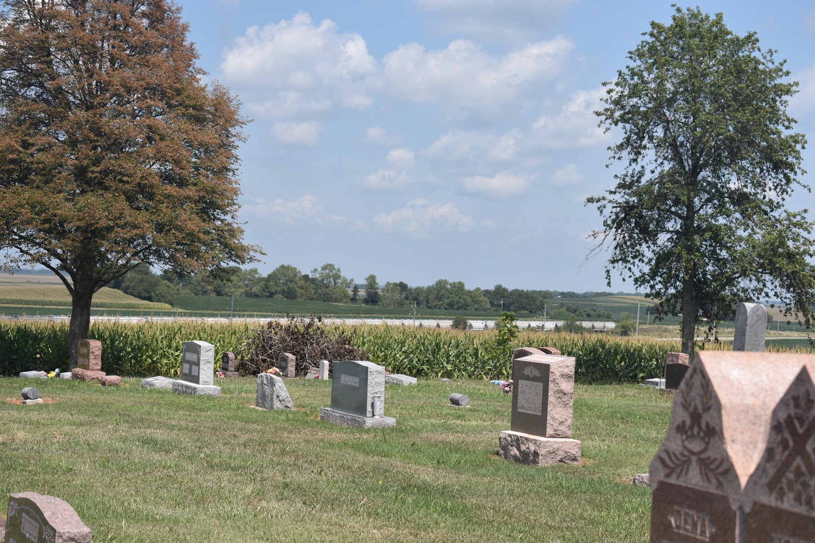
Ohlman cemetery, EM58ji looking towards EM58bv
Ohlman cemetery looking northeast towards Jim, W9SNR in EN51xr
Zack, W9SZ on site at Ohlman cemetery, EM59ji
Zack, W9SZ at EM59ji with 24 GHz attempting to work AF4JF in EM58bv
Gillespie, EM59bd site
Gillespie site EM59bv looking towards Dow, IL EM49ua
EM4838xv outside of Kingdom City, MO looking towards EM39ka
Em38xv looking west towards St. Louis
Centralia, MO, EM38xw working Bill, K0AWS via rainscatter using FM. The T-storm between the trees is about 43 miles to my southwest and 90 miles to Bill's southwest.
BARS members Ron, KO0Z and Herbert AF4JF made plans for the contest weekend. On Saturday, 19 August Ron put into play a "shoot and scoot" tactic. He activated four different locations. The first was east of Virden, IL EM59dm, the second was a hilltop farm near Raymond, IL, EM59fh, the third was Ohlman cemetery EM59ji and the fourth was Gillespie, EM59bd. Herbert spent most of the day near I-55 and IL Route 140, outside of Hamel, IL EM58bv.
Surprisingly, Ron, KO0Z wasn't able to communicate with Herbert, AF4JF from EM59dm to EM58bv, a path of only 41.2 miles. There must have been some obstruction. The path to Bill, K0AWU was blocked by a coal mine gob hill to the west. Zack was on the move from his EM50rl hilltop site.
Next Ron went to a hilltop farm near Raymond, IL, EM59fa with fabulous views in all directions except for northwest, north and northeast due to cornfields. The east, south and west views are great. If soybeans are planted next year, then the northern views should be excellent as well. KO0Z worked AF4JF in EM58 bv with good signals both ways. A path of 33.9 miles. Next, KO0Z tried to work Bill, K0AWU in EM39ta without any luck on either side. A path of 153.5 miles.
At Ohlman cemetery, EM59ji, Ron worked Herbert AF4JF. still at EM58bv, a path of 47.9 miles, with strong signals both ways. KO0Z tried working Ron, W9ZIH in EN51nv, a distance of 185.8 miles, and both ops were able to hear one another, but W9ZIH wasn't able to copy KO0Z's grid. Drats. A half-houir later, KO0Z tried again with similar results. In the meantime, Ron copied the WB9PNU/b at S-5 and its telemetry indicated 1.19 watt output, 12.94 VDC, 111.76 F beacon enclosure temp and a PA temp of 107.84 F. By this time Zack, W9SZ arrived at Ohlman cemetery. set up about 10 feet away from KO0Z and with many repeats he was able to successfully complete a two-way with Ron, W9ZIH! At 12:52, Ron worked Jim, W9SNR in EN51xr for a distance of 175 miles! Afterwards, Ron KO0Z drove 2.2 km from Zack's location and worked him before heading to Gillespie, IL EM59bd and Zack went on to Dow, IL EM49ua. Unfortunately, Zack had a hill in the direction of Gillespie and even though they were only 24 miles apart, they couldn't hear each other.
Ron's plans included activating a high spot with views to the west from on top of the bluffs overlooking Grafton, IL EM48sx, but the hot, humid sunny day was taking its toll. Herbert, AF4JF already called it a day, Zack, W9SZ promised a friend near Carbondale, IL that he'd be there by 8 pm and by this time it was already after 6 pm. Bill, K0AWU was back at the farm so there wasn't too many folks to work and to be perfectly honest, KO0Z's face was sunburned, not to mention, tired as well. So he wrapped things up from EM59bd and headed the 30 miles back home to Girard, IL to prepare for Sunday.
On Sunday, 20 August, Ron, KO0Z, Debbie, KC9ULA and Roman, KD9COA participated in the second day of the contest. Our first stop was at Edwardsville, IL ( EM48xs/EM59as) overlooking the Mississippi River flood plain towards St. Louis but not after a long delay to get there because IDOT closed I-270 westbound lanes for repaving which caused Ron some frustration. Herbert, AF4JF and Rich, N0PQU were set up outside of Kingdom City, MO, EM38xw and Bill was QRV from "Cow Hill" in EM39ka.Meanwhile as Herbert and Rich waited for KO0Z they worked Bill, K0AWU. Ron wasn't able to work Herbert, a distance of 95.5 miles or Bill a path of 167.1 miles. By this time, Ron was feeling cursed. Zack, W9SZ was set-up near Carbondale, IL but KO0Z didn't try to work him because he would have been aiming his dish at an apartment building only 50 feet away. Darn the luick. Ron did have successfully reading the WB9PNU/b about 23 miles away with telemetry of 1.26 watts out, 12.9 VDC, beacon enclosure temp of 78 F and a PA temp of 96 F.
Next stop was New Florence, MO, EM48 gv by the water tower, but what looked good on Google maps turned out to not be so good, so on to Danville, MO, EM48fv. at the truck stop rest area. Herbert was31.6 miles away and Bill was 90.2 miles away. Ron was shooting into some brush and the ridge on the other side of the big dip in I-70 near Mineola, MO may have been too high. No signals were heard.
On to Mineola EM49ev and I-70 exit 155 but trees, trees and more trees prevented any clear, unobstructed paths to the west. Ron scoured the area, went to Fulton and still wasn't able to find a suitable site. By this time we all wanted lunch at the Iron Skillet in Kingdom City, MO and Ron was there, but still no suitable westward site. Giving it the "old college try and with the patience of both Debbie and Roman, KO0Z did find a site with a view to the west from EM48aw near the University of MO prairie research lab. At 1:50 pm, KO0Z, KC9ULA and KD9COA worked Herbert, AF4JF and Rich N0PQU (5.3 miles) on CW and SSB but still no luck with Bill, K0AWU. So far, a somewhat rewarding, but very frustrating, disappointing day.
We gathered for lunch at the Iron Skillet in Kingdom City, MO for good food and to compare notes. It was great seeing Herbert and Rich. After lunch, Herbert and Rich returned home. Ron, Debbie and Roman continued west and went to Herbert's spot at EM38xw and finally, Ron KO0Z was finally able to put Bill, K0AWU into the log at 4:05 pm for a distance of 63 miles.Both Debbie and Roman were able to exchange SSB QSOs with Bill. By this time, Ron's Yaesu FT817 was acting strangely. Frequency split operation and problems switching between CW and SSB. At one point, Ron accidentally turned off his battery booster and his signal was drifting until he realized the problem and turned it back on and the drifting stopped. Repeated stops, set-ups and tear down's was beginning to take its toll on KO0Z.
Finally, Ron, Debbie and Roman made it to Centralia EM39wf to visit some friends, but before heading out to dinner, off to the east a line of thunderstorms extended between New Florence, MO to Hermon, MO. Ron called Bill on the phone to try some rainscatter. Ron's FT 817 was still on the blink. Perhaps the heat and the humidity along with operator error were to blame. Both Ron and Bill could see the Tstorms and we targeted the tallest one with an anvil forming. KO0Z could hear K0AWU"s strong rainscatter signal, but Ron's FT817 would not send CW. Drats. Not giving up, Bill suggested FM, but Ron's FM had a offset to it, but both he and Ron were able to successfully exchange call signs and grid squares for a distance of 55 miles between them. The actual radar indicated storm was 43 miles from Ron and 90 miles from Bill! Not too shabby!
Upon returning home, Ron, KO0Z looked at his cw key and wire, but found no broken connections. He couldn't find out what was wrong with his FT-817. He did a factory reset and his FT-817 is once again working properly. He wishes he would have had the documentation with him to have done this out in the field. Lessons learned.
A big shout out to Bill, K0AWS, Herbert, AF4JF and Rich, N0PQU for their patience, hard work, encouragement and sunburns!
We're planning now for Round 2 of the contest September.16 and 17! Leapfrog strategy is being discussed. Possibly up the Mississippi River Road and MO Route 79 or on to Herman, MO with a stop at Stone Hill Winery!
Hilltop farm outside of Raymond, IL EM59fh looking west.
Hilltop farm, EM58fh looking towards AF4JF in EM58bv
Ohlman cemetery, EM58ji looking towards EM58bv
Ohlman cemetery looking northeast towards Jim, W9SNR in EN51xr
Zack, W9SZ on site at Ohlman cemetery, EM59ji
Zack, W9SZ at EM59ji with 24 GHz attempting to work AF4JF in EM58bv
Gillespie, EM59bd site
EM4838xv outside of Kingdom City, MO looking towards EM39ka
Em38xv looking west towards St. Louis
Centralia, MO, EM38xw working Bill, K0AWS via rainscatter using FM. The T-storm between the trees is about 43 miles to my southwest and 90 miles to Bill's southwest.
Friday, August 4, 2017
23 July BARS Brunch Meeting 2017
Sunday, July 23, 10:30 am, Arnold, MO in EM48, BARS members gathered for our July brunch. We met at Ponderosa Steakhouse in Arnold. According to Google there are only three Ponderosa restaurants in the immediate area. Vandalia, IL, Washington, MO and Arnold. It was great seeing everyone and the breakfast fare was good.
We discussed general plans for the ARRL 222 and up contest, the 10 GHz and contest and the upcoming solar eclipse. We plan to be QRV as time, work and family situations dictate.
Harry, WA0CNS brought some microwave yagis for us to inspect and Herbert, AF4JF brought by his latest project - an affordable and easily constructed 10 GHz beacon to augment the existing WB9PNU/B. Without a PA, these beacons constructed by modifying an ELCOM synthesizer will produce about 10 mW out. This is sufficient drive for a 3 watt PA. Plans are to make three beacons. One to be placed in St. Peters, EM48qs, another near Troy, IL, EM59 and the other near Girard, IL, EM59ck.
As for Sunday, Aug 20, Ron, KO0Z plans to be QRV from Centralia, MO for the contest and for the solar eclipse on Aug 21. He and Debbie, KC9ULA will be in the path of totality. Ron is participating in W9FZ's Eclipse-O-Mania. Herbert may be active from either EM48, EM38 or EM49.
Our next brunch will be after the St. Charles ARC hamfest in O'Fallon, MO on Sunday, 13 August. Time and place to eat will be determined.
73 de Ron, KO0Z
Left to right: Debbie KC9ULA, Mike N0OBI Left to right: Bob N0IS, Herbert AF4JF
Harry WA0CNS, Bob N0IS and Herbert AF4JF Ron KO0Z, Debbie KC9ULA and Mke
N0OBI
Debbie, KC9ULA holding up a home brewed, 2.3 GHz yagi that Harry, WA0CNS brought.
The driven element of the commercial WiFi yagi antenna
Debbie holding up the commercial WiFi 2.4 GHz antenna Harry brought to brunch.
10 GHz slot antenna for the beacons
AF4JF's programmable controller with five sensors for the 10 GHz beacon
AF4JF's 3 watts 10 GHz PA for the beacon
Programmable controller on top of the Elcom synthesizer coupled to the 3 watt 10 GHz beacon
WA0CNS hairpin feed to his 2.3 GHz yagi.
Coaxial feed point to the 2.3 GHz yagi.
We discussed general plans for the ARRL 222 and up contest, the 10 GHz and contest and the upcoming solar eclipse. We plan to be QRV as time, work and family situations dictate.
Harry, WA0CNS brought some microwave yagis for us to inspect and Herbert, AF4JF brought by his latest project - an affordable and easily constructed 10 GHz beacon to augment the existing WB9PNU/B. Without a PA, these beacons constructed by modifying an ELCOM synthesizer will produce about 10 mW out. This is sufficient drive for a 3 watt PA. Plans are to make three beacons. One to be placed in St. Peters, EM48qs, another near Troy, IL, EM59 and the other near Girard, IL, EM59ck.
As for Sunday, Aug 20, Ron, KO0Z plans to be QRV from Centralia, MO for the contest and for the solar eclipse on Aug 21. He and Debbie, KC9ULA will be in the path of totality. Ron is participating in W9FZ's Eclipse-O-Mania. Herbert may be active from either EM48, EM38 or EM49.
Our next brunch will be after the St. Charles ARC hamfest in O'Fallon, MO on Sunday, 13 August. Time and place to eat will be determined.
73 de Ron, KO0Z
Left to right: Debbie KC9ULA, Mike N0OBI Left to right: Bob N0IS, Herbert AF4JF
Harry WA0CNS, Bob N0IS and Herbert AF4JF Ron KO0Z, Debbie KC9ULA and Mke
N0OBI
Debbie, KC9ULA holding up a home brewed, 2.3 GHz yagi that Harry, WA0CNS brought.
The driven element of the commercial WiFi yagi antenna
Debbie holding up the commercial WiFi 2.4 GHz antenna Harry brought to brunch.
10 GHz slot antenna for the beacons
AF4JF's programmable controller with five sensors for the 10 GHz beacon
(made by Tomas, OK1DXD)
AF4JF's 3 watts 10 GHz PA for the beacon
Programmable controller on top of the Elcom synthesizer coupled to the 3 watt 10 GHz beacon
WA0CNS hairpin feed to his 2.3 GHz yagi.
Coaxial feed point to the 2.3 GHz yagi.
Subscribe to:
Posts (Atom)