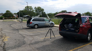
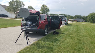
Saturday's forecast for the upcoming 2019 ARRL 10 GHz and Up contest didn't look very promising. Saturday called for a 40 to 50% chance of rain and T storms. Sunday was more bleak with a 70% chance of storms. Saturday was looking like the better choice. Herbert AF4JF, Harry WA0CNS and Ron KO0Z decided on Friday evening, after Herbert's work related flight Boston returned, to see what the morning's actual weather was like and to try and set up by 9:30 am.
Saturday's forecast was looking a bit better. Ron left his Girard, IL QTH by 7:15 am for the two hour trek across country roads to Pere Marquette State Park EM48rx overlooking Calhoun county, IL; western St. Louis county, MO, all of St. Charles county, MO as well as parts of Lincoln, Warren and Calloway counties in MO!
Ron KO0Z was anxious to activate Eagles Roost scenic overlook at Pere Marquette State Park, EM48rx. It has an unobstructed 120 degree view that extends from azimuth headings of 145 to 265 degrees from an approximate elevation of 800 feet!
Pere Marquette State Park's Eagles Roost scenic overlook offers a 120 degree panorama at an approximate elevation of 800 feet!
Ron KO0Z QRV on 10 GHz, from Eagles Roost EM48rx looking southeast towards Spot #1
Close up view of KO0Z's rig at Eagles Roost EM48rx
Eagles Roost sign was quite the draw for visitors which, at times, delayed KO0Z from making Qs
For round 2 of the contest, KO0Z would be the stationary station at EM48rx and AF4JF and WA0CNS would be the mobile, "shoot and scoot" operators, basically traveling west along Interstate 70.
By 9:30 am, Ron KO0Z was QRV from Eagles Roost. He could hear the WB9PNU beacon roaring no matter in which direction the dish was pointed. Telemetry indicated the power output to be 1.2 watts, 12.9 VDC, enclosure temp of 84.3 degrees F and the PA temp of 111.8 degrees F at 10:06 am.
The WB9PNU/b roared into EM48rx no matter where the dish was pointed southeast of Eagles Roost, EM48rx!
AF4JF and WA0CNS were QRV at a church, on a hill in western St. Louis county EM48sr, Spot #1 and at 9:48 and 9:50 am both of them were in KO0Z's log with 5x9 SSB reports. A distance of 17.8 miles (28.6 km).
Harry WA0CNS and Herbert AF4JF QRV from Spot#1, west St. Louis county EM48sr, a church parking lot.
Herbert AF4JF, EM438rt, Red Lobster in St. Peters, MO looking towards EM48rx
O'Fallon, MO EM48pt was Stop #3 next stop along the I-70 10 GHz odyssey, a distance of 14.6 miles (23.5 km). Strong, CW signals were present on both sides of the QSOs. Herbert and Harry were worked at 11:17 and 11:18 am KO0Z received a 579 report at EM48rx. Eagles Roost was proving to be a good operating location.
Harry WA0CNS along with Herbert at Stop#3, O'Fallon, MO EM48pt
Spot #3 O'Fallon, MO
Ever moving westward, Wentzville EM48nt became Spot #4. at 12:05 and 12.07 pm, both AF4JF and WA0CNS made a QSO with KO0Z on CW with good reports both ways for a distance of 21.3 miles (34.3 km). Herbert and Harry took a lunch break and Ron ate a left over hamburger sandwich along with an apple.
AF4JF and WA0CNS QRV from Spot#4, Wentzville, MO EM48nt
Lunch break for KO0Z...a hamburger sandwich at EM48rx.
By 12:50 and 12:52 pm, AF4JF and WA0CNS were back on the air from Wright City, MO EM48mu, Spot #5 with 599 CW signals to EM48rx! They were pounding in from a distance of 24.1 miles (38.8 km)! We also made 5x9 SSB contacts from that location!
Harry and Herbert QRV from Wright City, MO EM48mu, Stop #5.
Spot #6 in EM48kt, Warrenton, MO was another good location. From a distance of 33.5 miles (54 km) both Herbert and Harry were in the log at 1:45 and 1:47 pm with 579 and 599 CW signals.
AF4JF and WA0CNS QRV from Warrenton, MO, EM48kt, Stop # 6 along the way.
Continuing west, AF4JF and WA0CNS activated EM48iu in Jonesburg, MO, Spot #7. A distance of 41.3 miles (66.5 km) with 579 CW signals at 2:24 and 2:26 pm.
Next location, Stop #8 found Herbert and Harry at EM48gv, at the winery at New Florence, MO! Those scoundrels! It's been a running joke between us that we'd end up at winery on our 10 GHz expeditions. Herbert laughingly assured me that the winery was chosen for its location relative to EM48rx and not for a wine "tete a tete." :-) Still, a chilled glass of Reisling sounded mighty fine at that moment with the outside temp somewhere in the upper eighties! The winery was 49.7 miles (80 km) away and Herbert and I were able to work each other via rainscatter with 579 CW signals. Unfortunately, I wasn't able to hear Harry WA0CNS' signal from that location. We made the Q with AF4JF at 3:17 pm.
Although we were growing tired and we were nearing the 265 degree limit of my location, there were T storms between us, so the decision was made to press on! After all, nothing ventured, nothing gained. What the heck, we were here!
Spot #9 ended up being a few exits past Mineola Falls dip in I-70 in Calloway county, MO, EM48dv, near Williamsburg for a distance of 63.8, miles (101.5 km). Rainscatter was the propagation mode and at 4:08 pm I worked AF4JF with 579 CW signals and I worked WA0CNS with 579 rainscatter CW signals at 4:18 pm. The reason I took a while to work Harry was due to visitors to Eagles Roost. I didn't want to transmit a 10 GHz signal directly at them as they gathered to read the information sign.
As a matter of fact, a running joke for this odyssey was I could tell when Herbert and Harry were ready to get on the air because that's when groups of visitors would come to the scenic overlook preventing me from transmitting. It did, however, offer me the opportunity to explain what I was doing and to promote amateur radio. In fact, I met a very nice young, soldier, Joe, from Ft. Sill who is interested in DFing and he is interested in earning his ham license! I also met a group of Ferguson, MO who are into DIY.
Spot #10, our last location for the day, found AF4JF and WA0CNS in a new grid square just west of Kingdom City, MO. From EM38xw and with rainscatter, I worked Herbert at 5:35 pm with 559 CW signals for a distance of 80.8 miles (130 km). Unfortunately, more visitors arrived and we patiently waited for them to leave so I could work Harry WA0CNS. The raincloud had moved and I wasn't able to hear either Harry or Herbert. We'd lost rainscatter propagation. This location is north of my 265 degree boundary, so rainscatter was the only propagation mode available for this location along I-70.
Conclusions: All in all, this 10 GHz odyssey was a great adventure. We learned more about 10 GHz propagation. AF4JF and WA0CNS did a great job of "shooting and scooting." I met some nice visitors at Eagles Roost, but at times their presence was frustrating because I wouldn't transmit while they were there which necessitated patience on both ends of the QSO and time delays. On the other hand, it afforded me the opportunity to talk about ham radio. I came prepared with ample amounts of water to hydrate, I brought lunch and I had fruit to eat throughout the day since Eagles Roost is not close to any food venues. I brought along a book to read to pass the time in between Qs as Herbert and Harry traveled to the next stop. From prior trips, I knew there wasn't a water fountain at Eagles Roost. What I forgot was there also wasn't a outhouse. Keeping hydrated also meant bladder relief. The terrain is rugged. So, I would go down the slope, next to the platform, keep and eye out for visitors, and when safe, take care of business.
I saw a deer at the park's entrance, and at Eagles Roost, I saw a bald eagle soaring the thermals, a few turkey vultures riding the thermals, a big spider, butterflies and flies with iridescent blue backs. I spied two barges on the Illinois River below me and an approaching thunderstorm at 5:00 pm, threatened my "roost" at Eagles Roost, but it stayed to my west. The sound of thunder rolling in the park's hills was impressive.
By 6:00 pm, more than ready to call it a day, I packed up my gear into my red wagon, to assist me, bringing it back down the trail to the parking lot and my vehicle which worked out nicely. A young lady and her boyfriend had rose petals that they were scattering along Eagles Roost in anticipation of her brother proposing to his fiancée with an expected arrival of 6:15 pm. By 6:30 pm, I was on the road heading back to Girard. I stopped off at Jerseyville, IL, at a McDonald's, and two sausage and egg McMuffins, along with a large coffee later, I was back on the road heading home. A good day spent with nature, friends and ham radio!
Eagles Roost offers a great view. The first water body is the Illinois River and just above it is Swan Lake. Beyond that is Calhoun county, IL and the distant ridge is I-70.
A good, wooden bench, water and a good book occupied me in between QSOs.
The bench proved to be quite comfortable. Cloudy skies kept the sun off me. Temp was in the mid to upper 80s.
Eagles Roost platform. My 10 GHz rig is to the left and the sign, which proved to be quite popular with visitors is to the right. I didn't set up next to the sign, because I didn't want to block access to the sign. After all, this is a public, state park!
Below: sRadar Scope screen shots from my camera depicting the various T storms between me and Herbert and Harry.
The screenshot above is the T storm that provided rainscatter between EM48gv and EM48rx
A wider view of the EM48gv T storms. My location is north of St. Charles and west of Godfrey.


Nice, very detailed posting, thanks!
ReplyDelete